17 February 2009

NASA image courtesy MODIS Rapid Response Team, Goddard Space Flight Center
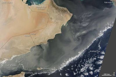
NASA recently published a spectacular image of a powerful dust storm that covered much of the Arabian Peninsula, on 12 February 2009. The storm thinned, and spread eastward over the following two days. The image was acquired by a sophisticated device aboard NASA’s Terra satellite, on 14 February 2009.
In this image, a massive dust plume extends to the coast of Pakistan. South of the Arabian Peninsula, dust has blown beyond Suqutrá, and is skirting the northeastern tip of Somalia. Little clouds delineate the plume’s southern edge. The gray area to the right edge of this image is due to a gap between satellite tracks.

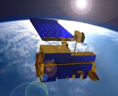
An artist’s impression on NASA’s Terra satellite
Credit: NASA
Terra was launched into space on 18 December 1999, aboard an Atlas rocket. It orbits Earth every 98.1 minutes, in an orbit whose altitude varies from 654 km to 685 km. Terra is the flagship of NASA’s Earth Observing System (EOS), a program consisting of a series of satellite missions, designed for long-term global observation of our planet. Terra carries a payload of five remote sensing instruments, to monitor the environment and ongoing climate change. It is approximately 4,900 kg in mass.
Further reading
Earth Observatory
http://earthobservatory.nasa.gov/
Terra Satellite
http://terra.nasa.gov/
Aymen Mohamed Ibrahem
Senior Astronomy Specialist